 Square
DP Remarks, Reservations and Road Widening: What to Check Before Designing Your Plot
A coloured development-plan map is a starting reference, not a buildable-area certificate. Before deciding where a building can sit, match the exact plot to the responsible authority, the relevant plan and the remarks that need professional interpretation.
Is a road line or reservation affecting your plans?
Tell Square Space the exact locality, intended use and the map or remark you are trying to understand. We can discuss the architectural planning questions and identify what needs authority confirmation or specialist assessment.
Calling? Mention the Square Space website. Share a description in the form, not private documents.
First make the references agree.
“Thane” can mean the city, district or a much wider property-search area. “Kalyan” in an address does not identify every planning boundary. Start with the village / ward, survey or CTS reference, available measured information and the actual parcel location. Do not choose an authority solely from the postal city.
Ask which development or regional plan applies and which authority can provide the relevant record. The Directorate of Town Planning’s General FAQ distinguishes a zone certificate under a sanctioned Development Plan from one under a Regional Plan and identifies the corresponding planning / town-planning route. It does not mean one portal or office serves every plot.
Three map questions that are easy to confuse.
| Term | Question it helps address | What not to infer |
|---|---|---|
| Zone / land use | What use category is indicated for the identified land in the relevant plan? | A zone label alone is not a sanction for your proposed building. |
| Reservation / designation | Is land identified for a stated public purpose or other plan provision? | A map colour alone does not settle your legal rights, compensation or a release route. |
| Road alignment / widening line | Does the relevant plan or authority record indicate a road provision that may affect the site? | A visible road edge or a screenshot measurement is not a verified boundary or a final design setback. |
The official DTP planning FAQs explain plans as land-use and infrastructure instruments. The practical task for your appointment is narrower: establish what the relevant record says about this parcel and which questions remain open.
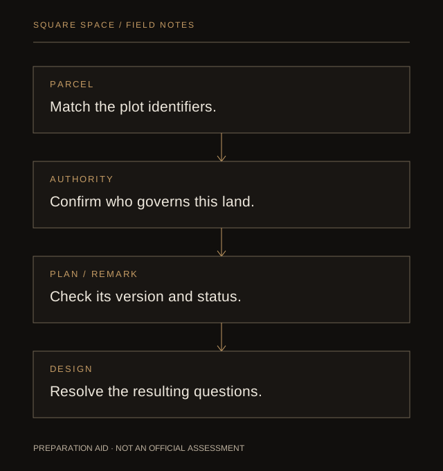
Ask what the map is—and when it applies.
Record the title, issuing body, sheet or reference number, date, legend and status of the material you receive. A draft proposal, sanctioned plan, later modification and an informal online overlay should not be silently treated as the same document.
- Does the plot reference match the document, including any subdivision?
- Is the image from an official source, a third-party map or a forwarded screenshot?
- What is the stated plan status, and are there subsequent authority records to check?
- Is a formal part plan, zone certificate or other remark appropriate to the question?
A general article cannot determine the current operative position for an individual site. Where draft and existing provisions both appear relevant, ask the appointed professional and authority to identify their applicability. Do not assume an older plan has vanished merely because a newer draft can be downloaded.
If a line crosses the site, do not jump to an FSI calculation.
First check that the line has been located against the correct parcel and that its meaning has been established from the legend and authority record. Then identify the architectural consequences that need assessment: available arrangement, access, circulation, servicing and the information needed for further design.
A suitable measured survey may be necessary to relate the plan information to the land. Legal questions about reservation, acquisition, title, objections or compensation require the appropriate independent advice. This page does not promise a reservation can be removed or that a stated road provision is final.
Where the question is an entrance onto a controlled road rather than a planning-map line, use the road-access NOC guide. They are connected project issues, not the same permission.
Bring a small decision register, not a guessed layout.
| Bring / note | Question for the discussion |
|---|---|
| Parcel identity and location | Have we located the same property in every record? |
| Map / remark reference and date | Which source and plan status should the appointment rely on? |
| Intended building use | Which architectural arrangement are we assessing? |
| Known road, access or reservation concern | What needs to be resolved before concept design? |
| Unknown or conflicting information | Which authority, survey or legal input should be obtained next? |
For example, a forwarded map may show a line near your plot while a seller describes the land as “fully usable”. Keep those as two statements to verify, not two equally reliable design inputs. This is a representative situation, not a Square Space case study.
Discuss the plot before committing to a scheme.
The site-feasibility page explains the initial conversation. For Kalyan or Thane, identify the actual parcel and intended use in your enquiry. The structured-planning service can then be discussed against an agreed scope, with specialist inputs where needed.
Sources & scope.
- Directorate of Town Planning and Valuation — planning / regional-plan / general FAQs
- Official MRTP Act reprint — text dated 10 March 2025; check subsequent amendments
General map-reading and preparation guidance, not an official DP remark, measured survey, legal opinion or statement of development entitlement. No FSI, reservation-release or compensation outcome is promised. Sources reviewed 18 October 2026. Portal interfaces and applicable provisions can change.
Is a road line or reservation affecting your plans?
Tell Square Space the exact locality, intended use and the map or remark you are trying to understand. We can discuss the architectural planning questions and identify what needs authority confirmation or specialist assessment.
Mention the Square Space website when calling. An appropriate paid scope, if needed, is agreed after discussing your requirements.